
2026 Greenville County Traffic Data

Greenville County is known for its vibrant communities, scenic surroundings, and Southern hospitality. Unfortunately, car accidents are a reality many residents face every year. Here, we provide a clear look at the latest statistics on motor vehicle crashes in Greenville County and across South Carolina.
Greenville, SC Roadways & Highways Incidents
Interstate Highways and Major Routes with High Crash Risk
- Interstate 85 (I‑85)
- High number of collisions and speed‑related crash involvement in Greenville County reported statewide, contributing to many serious wrecks.
- Interstate 385 (I‑385)
- Frequent accidents, especially where it intersects with other major roads and ramps due to heavy commuter and commercial vehicle traffic.
- U.S. Highway 25 (US‑25)
- One of the county’s highest collision routes with reported fatal crash counts on certain stretches such as Frontage Road to Farrs Bridge Road.
- U.S. Highway 29 / Wade Hampton Boulevard
- Heavy traffic volume with frequent rear‑end and side‑impact crashes due to congestion and commercial traffic flows.
City of Greenville High Injury Network Roads
- Laurens Road
- Noted as one of the most dangerous road corridors with high injury and fatal crashes.
- North Pleasantburg Drive
- High occurrence of injury and fatal collisions along key sections within city limits.
- Woodruff Road
- Recognized for heavy traffic, congestion, and higher crash rates.
Sources: Greenvillesc.gov
Other Local Roads and Dangerous Segments
- White Horse Road (part of US‑25 corridor)
- Known for fatal accidents and pedestrian crash incidents reported in county data and national comparisons.
- Pleasantburg Drive (SC‑291)
- Multiple intersections and commercial access contribute to frequent collisions.
- Stone Avenue (near downtown Greenville)
- Has seen notable numbers of injury crashes along a short central stretch.
- Haywood Lane
- Corridor feeding major thoroughfares with a significant injury crash count.
Common Crash Factors on These Roads
- Distracted driving and failure to obey traffic signals lead to many collisions on high‑volume corridors.
- Speed‑related crashes contribute heavily to incidents on interstate and primary routes.
- Intersections and merge points on major arterials see a large share of injury and fatal collisions due to conflicting traffic movements.
Source: 2023 Fact Book
Fountain Inn, SC Roadways & Highways Incidents
High‑Traffic Roadways with Elevated Crash Exposure
- Interstate 385 (I-385):
- A busy highway near Fountain Inn where crashes often cause lane closures, especially near Exit 23. Interstates account for many serious and fatal crashes across South Carolina.
- SC Highway 14 (Main Street):
- Runs through Fountain Inn with heavy daily traffic. Busy intersections increase the chance of crashes.
- SC Highway 418:
- Connects to I-385 and passes through Fountain Inn. Crashes often happen at intersections along this route.
Important Local Intersections and Crash‑Prone Areas
- I-385 Interchange (Exit 23):
- Heavy merging traffic near SC-418 and SC-14 makes this area prone to crashes. Past accidents have caused highway closures.
- SC-14 and SC-418 Intersections:
- Busy crossings inside Fountain Inn with high traffic volume. These intersections see more crashes and emergency responses.
Crash Data Indicators from Official Sources
- Traffic Collision Frequency near Fountain Inn
- According to the South Carolina Department of Public Safety Traffic Collision Fact Book 2023, the Fountain Inn Police Department investigated 191 collisions, including 8 injury collisions and one fatal collision, reflecting local crash exposure within city limits.
- Greenville County Traffic Collision Context
- Greenville County (which includes Fountain Inn) is among the highest in South Carolina for total collisions, injury collisions, and fatal collisions statewide, suggesting roads in and around Fountain Inn share that elevated risk environment.
Source: 2023 Fact Book
Common Crash Risk Factors on Fountain Inn Roads
- High Traffic Volumes
- I‑385, SC‑14, and SC‑418 carry heavy commuter and through traffic, increasing exposure to potential crashes.
- Interchange and Merge Conflicts
- Merging and weaving traffic at interstate on and off ramps, especially around Exit 23, leads to greater conflict points and reported collisions.
- Intersection Conflict Points
- Where two state highways or arterial roads meet (such as SC‑14 and SC‑418), conflicting movements raise the likelihood of crashes.
Greer, SC Roadways & Highways Incidents
Major Roadways with High Crash Exposure
- Wade Hampton Boulevard (US-29):
- One of South Carolina’s most dangerous roads. Multiple fatal crashes have happened along this corridor in and near Greer.
- SC Highway 14 (SC-14):
- Runs through Greer and connects with major local roads. Crash reports often involve busy areas like Chandler Road.
- SC Highway 101 (SC-101):
- Injury crashes are reported at signalized intersections near Greer, especially outside downtown.
- SC Highway 80 (J. Verne Smith Parkway):
- A four-lane bypass used by trucks and fast traffic. At-grade intersections and merging increase crash risk.
- SC Highway 290 (SC-290):
- Passes through Greer and connects to other busy roads. Heavy traffic and complex turns lead to frequent crashes.
- SC Highway 357 (SC-357):
- Starts in Greer and serves as a rural connector. Crash risk rises where it meets busier city roads.
High‑Crash Intersections and Local Hot Spots
- Suber Road and West Wade Hampton Boulevard
- Local news reported an injury crash here, highlighting this intersection’s heavy afternoon traffic and conflict points.
- West Wade Hampton Boulevard and West Poinsett Street
- Another collision reported in Greer with injuries, illustrating traffic conflict areas near central thoroughfares.
- Highway 101 and Brockman‑McClimon Road
- Wreck reported with injuries underscores this junction’s risk due to cross‑traffic and signalized movements.
- Interstate 85 Exit 60 and Highway 101 area
- Reported crash caused closure of the exit ramp and backup on I‑85, showing how interstate interchanges can generate serious safety issues around Greer.
- Various signalized points on US‑29 (Wade Hampton Blvd)
- Frequent collision reports around lane changes and turning movements at mid‑block signals and intersections.
Local Crash Risk Patterns
- Greer Police crash responses
- City public safety alerts list trouble spots such as Highway 14 at Chandler Road where police responded to multiple wrecks.
- Speed and merge risk near expressways and major state routes
- High speeds on SC‑80 and merge points to SC‑14 and US‑29 contribute to increased crash likelihood.
Official Data Context for Greer and Greenville County
- Statewide Crash Reporting System
- South Carolina uses the Traffic Collision Fact Book from the Department of Public Safety to track crashes on interstates, highways, and local roads. This data helps show traffic risk in Greer.
- Greenville County as a high crash county
- Greenville County, which includes Greer, reports some of the highest crash and fatality totals in the state. This means Greer roads have higher crash exposure.
Mauldin, SC Roadways & Highways Incidents
High‑Traffic Roadways with Elevated Crash Risks
- Interstate 385 (I‑385) near Mauldin
- A major interstate carrying heavy commuter and freight traffic has been the site of serious collisions, including crashes that closed all northbound lanes near mile marker 32 for hours.
- Interstates generally, including I‑385, are linked with elevated fatal and injury crash counts in Greenville County’s traffic collision reports.
- U.S. Highway 276 (US‑276 / Poinsett Highway) through Mauldin
- A primary arterial connecting Greenville and northern suburbs, with high vehicle volumes contributing to increased collision exposure on this corridor.
- South Carolina Highway 417 (SC‑417 / Main Street and Laurens Road)
- A state route beginning in Mauldin that carries significant local and regional traffic. Busy sections near intersections with other primary roads see frequent vehicle conflict points.
Key Intersections and Local Crash Hot Spots
- Main Street and East Butler Road
- A reported crash involving a Mauldin Fire Department vehicle occurred at this intersection, illustrating it as a point of collision activity within town limits.
- Interstate 385 ramps and merge areas
- Areas where local roads meet the interstate ramps in Mauldin see high speeds, merging conflicts, and crash incidents leading to lane closures and emergency responses.
- Busy signalized junctions along SC‑417 and SC‑417 connectors
- These intersections carry heavy commuter traffic and multiple turning movements, increasing the potential for rear‑end and angle crashes on state highway segments.
Local Crash Data Indicators
- City of Mauldin collision counts in official reports
- Official state data shows Mauldin police investigate many crashes each year, including injury and property damage accidents. This points to ongoing traffic safety concerns.
- Cruising and enforcement context
- Mauldin has an active traffic safety team that targets speeding, aggressive driving, and problem intersections. This helps identify high-risk areas across the city.
Common Crash Risk Factors in Mauldin
- High traffic volumes on major local and regional connectors
- Roadways that serve as connections to Greenville and I‑385 see heavy commuter and freight flows that raise exposure to collisions.
- Interstate merge and ramp conflicts
- Merging traffic and varying speeds at freeway ramps increase conflict points for crashes.
- Urban intersections with signalized turning movements
- Multiple turning lanes and cross‑traffic movements at busy state route intersections contribute to rear‑end and angle collisions.
Simpsonville, SC Roadways & Highways Incidents
Major Roadways and Highways with Elevated Crash Exposure
- Interstate 385 (I‑385) through Simpsonville area
- A busy interstate with heavy commuter and truck traffic. Reported crashes often cause injuries and lane closures, including near Exit 29.
- South Carolina Highway 14 (SC‑14) through Simpsonville
- Runs through Simpsonville and connects nearby cities. High daily traffic increases the chance of crashes.
- South Carolina Highway 417 (SC‑417 / East Curtis Street and Laurens Road)
- A key state route that connects to I-385 and other major roads. Regional traffic adds crash risk.
- Fork Shoals Road at New Harrison Bridge Road area
- A local road west of Simpsonville where a fatal crash occurred, showing risk at rural intersections.
Notable Crash Sites and Local Dangerous Segments
- Georgia Road near Rocky Creek Road
- Location of a single‑vehicle fatal crash where a driver ran off the road, indicating this segment is prone to serious collisions.
- Neely Ferry Road near Border Avenue
- Scene of a deadly crash investigated by state patrol, highlighting risk on this local collector road.
- West Georgia Road at East Standing Springs Road intersection
- Reported intersection where a crash involving a Greenville County deputy occurred, underscoring collision potential at commercial area crossings.
- Grandview Drive near Fairview Road
- Reported overturned vehicle incidents showing that even residential connectors and collector roads see significant traffic safety events.
- Holland Road
- Holland Rd is identified as narrow and challenging to drive safely by local traffic accounts, suggesting a recurring risk for motorists.
Crash Data Indicators from Official Sources
- Simpsonville Police Department collision counts
- Simpsonville Police reports: State data shows Simpsonville Police investigate hundreds of crashes each year, including injury and fatal accidents. This highlights ongoing crash risk within the city.
- Greenville County
- Greenville County context: Greenville County, which includes Simpsonville, ranks highest in South Carolina for total crashes and serious injuries. This places Simpsonville in a high-risk traffic area.
Common Crash Risk Factors on Simpsonville Roads
- High‑Volume Traffic Near Interstate Ramps and Major Routes
- SCDOT data shows roads connecting to I‑385 and state highways carry heavy commuter loads, increasing conflict points and crash likelihood.
- Rural Collector and Local Road Segments
- Roads such as Neely Ferry Road and Rocky Creek Road outside the central business district still see serious collisions, particularly single‑vehicle run‑offs.
- Signalized and Unsignalized Intersections
- Intersections like West Georgia Road at East Standing Springs Road illustrate typical crash scenarios where turning and merging traffic interact.
Travelers Rest, SC Roadways & Highways Incidents
Major Roadways and Highways with Elevated Crash Exposure
- U.S. Highway 276 (Poinsett Highway)
- Main road through Travelers Rest that connects to Greenville. The road narrows in town, and changing speeds increase crash risk.
- State Park Road
- A busy local road with key intersections. A fatal crash happened near Tubbs Mountain Road.
- Tubbs Mountain Road
- Local connector in the River Falls area. Serious crashes have occurred where it meets State Park Road.
- Locust Hill Road
- Site of a head-on crash near Dean Williams Road, showing risk at rural and neighborhood intersections.
Key Intersections and Crash‑Prone Spots
- Tubbs Mountain Road and State Park Road
- Identified as the location of a fatal crash involving an elderly driver, showing that intersections of local roads with high traffic volumes or limited visibility pose serious hazards.
- Locust Hill Road near Dean Williams Road
- Location of a head-on crash in Travelers Rest that resulted in deaths and injuries, indicating danger where rural roads intersect near residential and local traffic areas.
Other Road Safety Indicators
- Travelers Rest Police Department Crash Reporting
- State data shows Travelers Rest police respond to a steady number of crashes, reflecting local traffic risk.
- Statewide Road Safety Trends
- South Carolina has high fatal crash rates on rural and two-lane roads. Travelers Rest roads follow these same patterns.
Common Crash Risk Factors in Travelers Rest Roadways
- Traffic Volume Changes
- U.S. 276 shifts from fast traffic to a slower downtown street, increasing conflict.
- Intersection Conflict
- Intersections of local roads like Tubbs Mountain Road and State Park Road create multiple conflict points for drivers.
- Head‑on Collision Risk
- Two-lane rural roads like Locust Hill Road carry higher risk when vehicles travel in opposite directions.
South Carolina Roadways & Highways Facilities (2020-2025)
Statewide Traffic Fatalities by Year
- 2025 (preliminary): About 880 traffic deaths statewide, the lowest total in several years.
- 2024 (preliminary): Around 1,015 traffic deaths, showing a small drop compared to 2023.
- 2023 (final): 976 fatalities reported in the SCDPS Traffic Collision Fact Book.
- 2022 (final): 1,018 fatalities, down from the higher numbers seen in 2021.
- 2021 (final): 1,112 fatalities, the highest total of the decade.
- 2020 (final): 964 fatalities on South Carolina roads.
Data sourced: SC Department of Public Safety, South Carolina Policy Council, & WRHI.
Key Patterns Over Time
- Highest point in 2021: Traffic deaths peaked in 2021 with 1,112 fatalities, then dropped in 2022 and 2023 (South Carolina Policy Council).
- Recent downward trend: Early data for 2024 and 2025 shows traffic deaths continuing to decline compared to earlier years (SC Department of Public Safety).
- Higher-than-average risk: South Carolina has long had a higher traffic death rate than the U.S. average, especially in earlier years like 2020 (Center of Connected Multimodal Mobility).
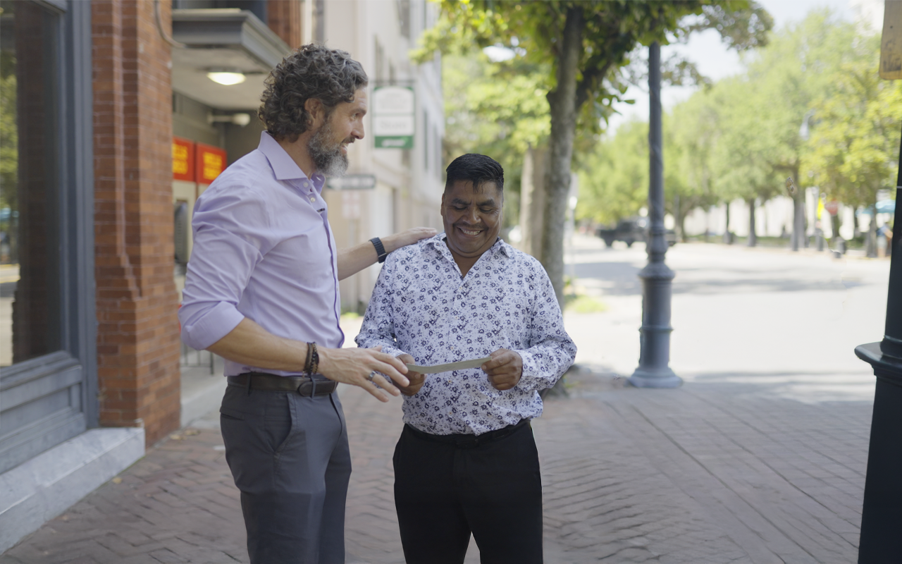
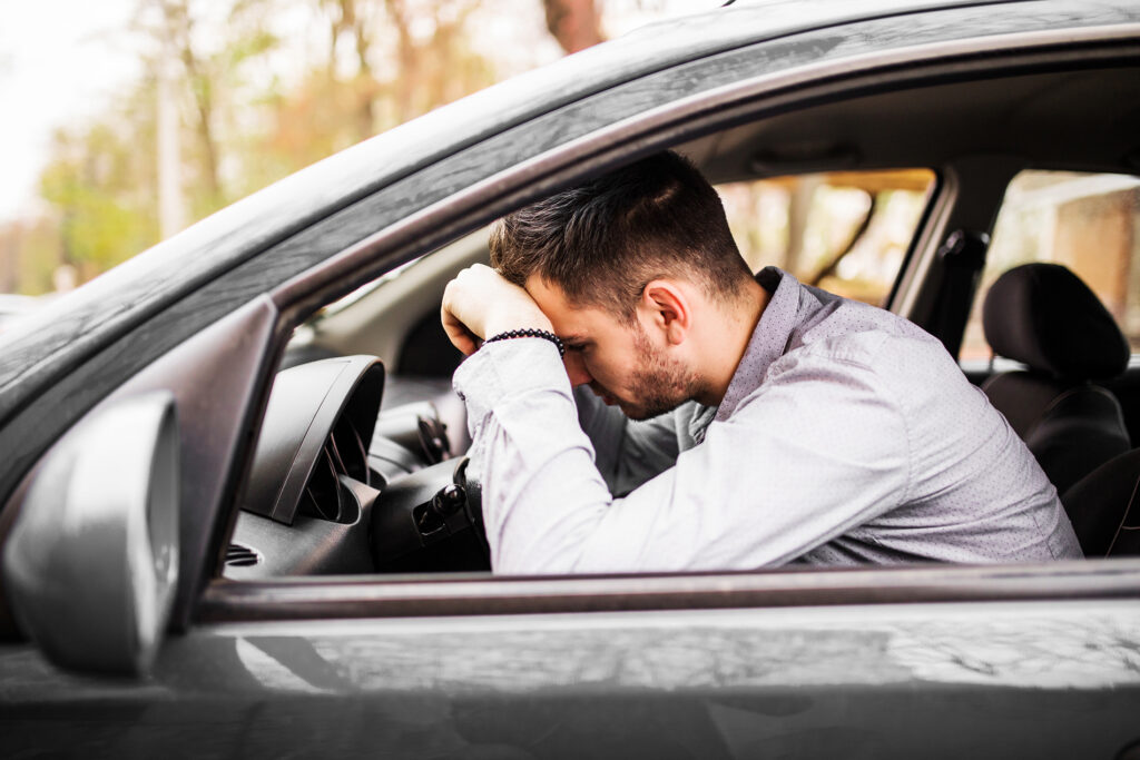
Hurt in Car Crash? Armada Law is here to help.
A serious accident can disrupt your life in ways you never expected. At our Greenville car accident law firm, our skilled team provides supportive, personalized legal guidance while fighting to secure the compensation you need.
We handle cases involving:
- Car and motorcycle collisions
- Truck and commercial vehicle accidents
- Guidance through claims and legal protection
How it works:
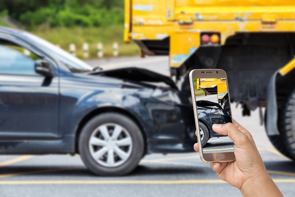
- Free Consultation – Share your story with us at no cost.
- We Build Your Case – We collect police reports, medical records, and other key evidence to strengthen your claim.
- Receive Your Compensation – We negotiate on your behalf so you can get the settlement needed to cover bills and move forward.
Take the first step toward recovery. Reach out to Armada Law today for a free consultation and let us help you get back on track.
Armada Law
Free Case Review — Available 24/7 by Phone, Email, or Online Form
Disclaimer: The information on this website is provided for general informational purposes only and is not legal advice. Viewing this site, submitting information, or contacting Armada Law does not create an attorney-client relationship.
Traffic statistics, crash data, and safety information are based on publicly available sources provided. These numbers are estimates or preliminary counts and may change. They are provided for informational purposes only and do not guarantee outcomes or predict specific incidents.
Legal content is intended to explain general South Carolina laws and procedures. Results of any case vary based on the facts of each situation. Past results do not guarantee future outcomes. Images shown for illustration purposes only. Attorney advertising. Armada Law is responsible for the content of this website.